Visualize Your Fleet With Maps
Fleet Management: A Picture Paints A Thousand Words
Maps are an integral part of any tracking system. With our vehicle tracking system, we've added some great value by utilizing maps in some very unique ways. We think they really help the user understand what's going on with their vehicles quickly and easily. We make it possible to dig into the data and SEE it. While they often report at different intervals, we've made sure that the maps work equally well with our asset trackers as they do with our vehicle trackers.
Maps Tell a Story
Visualize and manage your fleet presence with automatically updating maps. Either view the whole fleet, a subfleet or follow one unit. By creatively using icons, text, colors and lines, we make every map view tell its own story. At-a-glance, you know the vehicle, and depending on the view, the subfleet, the timestamps, the trail, and even the event.
Multiple Maps
If you're on the fleet map, its easy to click the configure link and add two more maps which can show specific units or a whole subfleet. All three maps update regularly. This allows you to watch multiple activities simultaneously.
Auto Refresh
Our maps don't offer a fixed static view, they update as we get new information from the server. On the mobile apps, we help manage your data by making the auto refresh feature optional.
Full-Screen Maps
Many of our customers, who dispatch fleets, have a big-screen monitor with our simplified fleet map on display. We remove our control menu and just show you one really, really big full screen map.
Public Maps
With Public Maps, we enable our customers to send a link to their customers or vendors showing a unit's status in real-time. You can even include a route to enable the viewer to see progress. The link can also be configured to expire so you don't have to actively manage it.
Icons, color coding and more...
You can choose from a huge set of icons when setting up your units. For special reports, like hard braking, idling, stationary, we have easy to understand icons that you'll know at a glance.
SubFleets
You can also group your units in SubFleets that can be color coded on the map for easy identification. SubFleets can also be used to control what's displayed on the maps.
Playback
The playback mode makes it easy to review the activities of the vehicles in the fleet throughout the day. Your full history is available, so pick any day to review.

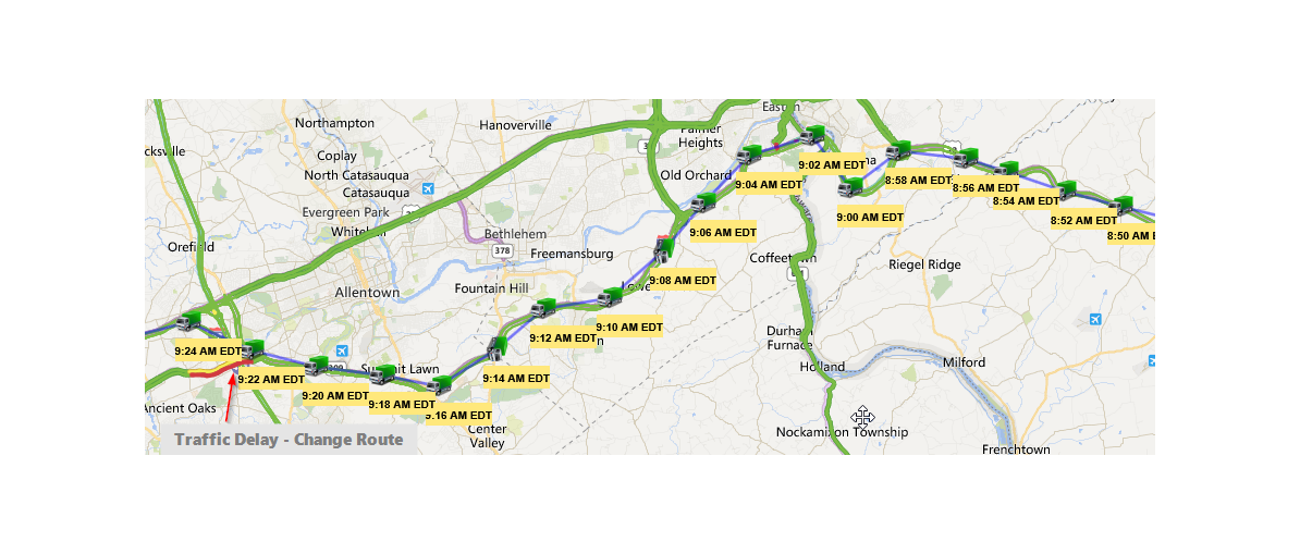
Traffic
The mapping software also shows realtime traffic information giving you additional perspective while you dispatch your cars and trucks.
Landmarks & Geofences
Use landmarks or geofences to manage worksites or customer locations. Most reports give distance to nearest landmarks. Enter and Exit alert emails can be used on Geofences.
Integrated into Reports
Where it makes sense, we've integrated maps into our reports by including a one click 'MapIt' button that displays a map with data from the report. This makes it easy to view data 'textually' and simultaneously visually. Making analysis easier and faster.